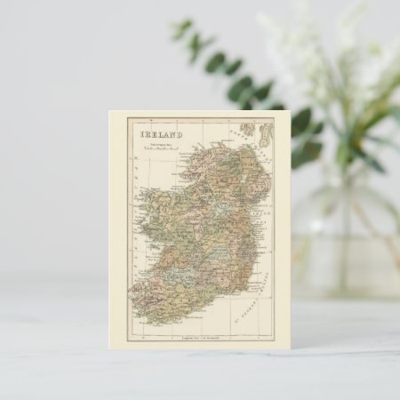
Vintage Map Of Ireland 1862 Postcard
By Digital Dreambuilder
Vintage Map Of Ireland 1862 Postcard
Fully customizable Vintage Map of Ireland 1862 Postcard created by DIGITALDREAMBUILDER. Personalize this product with your own text and images (if the design allows it) and create a gift for yourself, a loved one, for your event or your business. Product Type Zazzle Postcard2. Style 4.25x5.6.
The vintage map of Ireland from circa 1862 shows the former names of County Offaly as King's County, and County Laois as Queen's County with Maryborough (now Portlaoise) as the county town. Kingstown, shown on the map about 10km south of Dublin was renamed Dún Laoghaire in 1920.
The Most Popular Gifts By Digital Dreambuilder | ||
|---|---|---|
|
|
|
|
|
|
|
|
|
|
|
|
|
|
|
|
Browse this Designer's Gallery: All Products
Browse This Designer's Store at Zazzle: Most Popular
